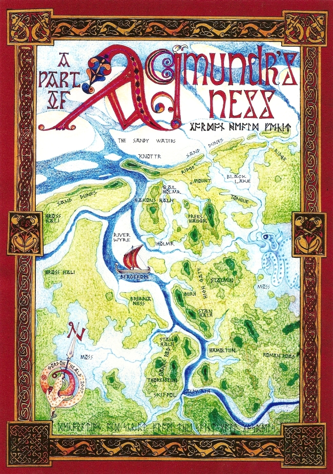
Map 2 The Wyre Estuary in the Viking Age

The Wyre Estuary and Over-Wyre in Maps
Map 2 The Wyre Estuary in the Viking Age

During the Viking Age, 8th. to 10th. centuries AD approx., Lancashire was part of the Irish Sea Celtic/Norse cultural zone centred on the Isle of Man. Amounderness, the area between the Lune and the Ribble , is named after a Norseman called Agmundr, whose Ness or promontory it was. At that time the coast would still have been basically unprotected from the sea and the mosses undrained, so the waters still ruled.That the Vikings sailed their longships up the Wyre is beyond doubt; their personal, settlement and topographical names litter the area. Haakon settled at Hackinsall, ships rode in the Skippool,and horses were pastured in the Hross Hali (Rossall). The Knottr, the Old Norse name for that glacial drumlin whose sea eroded remains are still called the Great Knott, was then a considerable hill, and what a dominant feature at the mouth of the Wyre it must have been!. Thus Knott-End-on-Sea gained its name.
The map shows many place names in their original Old Norse form. The style of script and decorative features used are from the St. Gall Gospels, a manuscript of the same period and cultural tradition, but the Runes are Anglo-Saxon for reasons of ease of transcription. Strange mythological creatures abound; men, animals and abstract patterns intertwine; an impossible animal points a spear to the North and a Marsh Monster, such as that slain by Beowulf, lurks in the depths of the Moss.
The computer screen does not do justice to Gordon's maps. If you would like to obtain your own high resolution copy follow this link for the details: High Resolution Maps.
 More maps

Return to the Map Index Page.
 IrfanView.