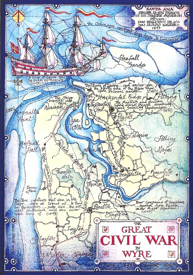
Map 4 The Wyre and Preesall in the Civil War: 17th. Century

The Wyre Estuary and Over-Wyre in Maps
Map 4 The Wyre and Preesall in the Civil War: 17th. Century

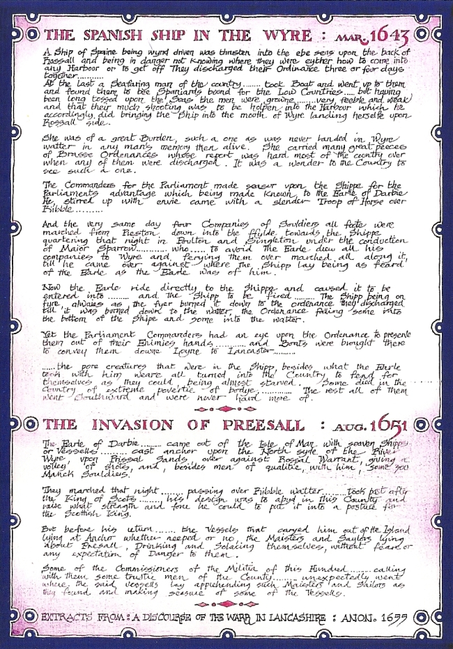
A considerable amount of action took place in Lancashire during the Civil Wars, of which the Wyre and Preesall saw their share, partly because the Wyre was an attractive landing place and partly because of the existence of the now forgotten north-south route across the Ribble at Freckleton and the Wyre at Shard.In March 1643 a Spanish frigate of the Dunkirk squadron, with a lost and starving crew,was stranded on the sands off Rossall. This event provoked both sides in the war to attempt to seize the ship and its guns for themselves regardless of ownership. Marches and counter- marches followed; the Earl of Derby advanced across the Ribble, Major Sparrow crossed the Wyre at Shard, resulting in a face-off across the Wyre at Preesall. The ship was burned, the guns ended up in Lancaster, and the crew were simply turned out to fend for themselves. There is no record of what became of them. A sorry affair.
In August 1651 the Earl of Derby, who was also the King of Man, led an invasion force from the Isle of Man. They are said to have landed on the "north side of the River Wyre", on Preesall sands, possibly indicating that the main flow was still out to the west at that time. Derby rode south to join the King, leaving the sailors "drinking and solacing themselves" in Preesall until they were seized by a Parliamentary force and their commander, Captain Cotterell, taken to York and hanged. The large number of musket balls unearthed in the grounds of Parrox Hall may date from this time.

Rather more major events took place along what is now the A6 corridor, the most important of which was the rout of the Royalist forces by Cromwell at the battle of Preston in 1648.
All the above affairs were described in detail in ' A Discourse of the Warr in Lancashire', published by an anonymous author in 1655. It is thought that he must have been a local man because of the extent and detailed nature of his knowledge.
The computer screen does not do justice to Gordon's maps. If you would like to obtain your own high resolution copy follow this link for the details: High Resolution Maps.
 More maps

Return to the Map Index Page.
This page has been optimised for viewing on a computer browser. It may appear somewhat ragged if viewed on an iPad, iPhone or similar tablet.
 IrfanView.